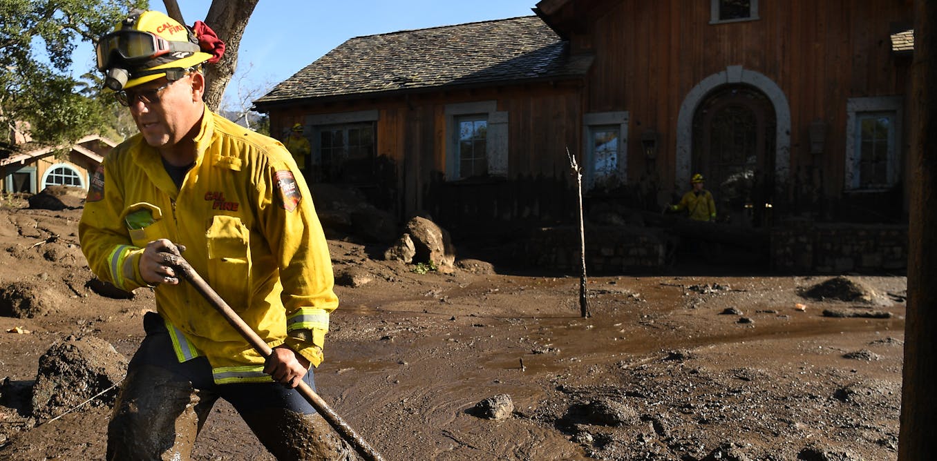
I made my first trip to Tahoe since 2nd week of July. AQI readings of 164 and 148 for South Lake Tahoe Mon and Tues, worried me a little, but it was better Wed and much better after that. I had a couple of obligations near Foresthill and E of Auburn on my way up before joining Truckee friends for early dinner Wed evening where it was breezy and refreshingly in low 70s. I mountain biked N* on Thursday, then attended last Music of the season at Tahoe Lakeshore Lodge where they gave a local Fire Captain the mic before the music started. He thanked everyone for the great evacuation they made and got a lot of cheers. Usually this music series ends in late August, but since last concert was cancelled due to Caldor Fire, two bands joined forces and put on a great show, going past scheduled end time to play "Feelin' Alright'. The only fire I saw that night was the Tiki torches they light for the 6-8 PM show. My South Tahoe friends all had blankets, while I was fine in shorts, sandals, jacket and a bit of Zin.


I had obligations in San Jose Friday late afternoon so I got out of cabin before 10 AM after draining water so I don't have to make emergency trip in what looks busy for me next couple of month. There was a lot of ash in cobwebs around cabin windows that I knocked down and a little on driveway. Neighbor said it was a lot worse before rain a couple of weeks ago.
Smoke level in town of South Take Tahoe was very low, but there were pockets of it towards High Meadows (S of Heavenly) and around Echo Lake. Highway 50 had signs warning about "Multiple" (places with traffic) "Controls", but I did not have any stoppages due to all the fire-related activity along and off the edge of road. Speed limit for first 25 miles from Meyers was posted at 45. I was stuck a couple of cars behind someone slower.
First picture is burnt trees on South side of 50, just W of Echo Summit (not Pass!), near where I parked and hiked to Lake Audrain a few years ago.

Next picture is hill above Twin Bridges where ground cover burnt, but some trees may be OK. Some of Horsetail Falls is right of center and Mt Ralston is to right. Last picture is Lovers Leap where it was hard to tell how much had burnt. I don't think I've ever seen American River so low.


I had obligations in San Jose Friday late afternoon so I got out of cabin before 10 AM after draining water so I don't have to make emergency trip in what looks busy for me next couple of month. There was a lot of ash in cobwebs around cabin windows that I knocked down and a little on driveway. Neighbor said it was a lot worse before rain a couple of weeks ago.
Smoke level in town of South Take Tahoe was very low, but there were pockets of it towards High Meadows (S of Heavenly) and around Echo Lake. Highway 50 had signs warning about "Multiple" (places with traffic) "Controls", but I did not have any stoppages due to all the fire-related activity along and off the edge of road. Speed limit for first 25 miles from Meyers was posted at 45. I was stuck a couple of cars behind someone slower.
First picture is burnt trees on South side of 50, just W of Echo Summit (not Pass!), near where I parked and hiked to Lake Audrain a few years ago.
Next picture is hill above Twin Bridges where ground cover burnt, but some trees may be OK. Some of Horsetail Falls is right of center and Mt Ralston is to right. Last picture is Lovers Leap where it was hard to tell how much had burnt. I don't think I've ever seen American River so low.