• For more information on how to avoid pop-up ads and still support SkiTalk click HERE.

Desolation

luliski

Making fresh tracks
Skier
SkiTalk Supporter
Joined
May 17, 2017
Posts
2,569
Location
California
Per @SSSdave request, I’m starting a Desolation Wilderness thread. It seems like some of us have spent lots of time there and have pictures and maybe reports to share. I’ve explored the area a bit, but haven’t gotten my fill yet.

I’ve been recovering from an injury all summer, and never made it to Desolation before the fires started. But I have pics to share from last spring and summer. I’ll start with my first pandemic-era visit to Desolation, in late May of 2020. My brother-in-law and I hiked up to Ralston Peak from the Ralston Peak trailhead. It’s a 6.2 mile hike round trip, with 2707 ft of elevation gain. There was still some snow on the trail, and close to the summit we ended up off trail and in shallow snow, on and off. Unfortunately, we didn’t start our hike until noon, and I had run a race-pace 5k that morning (doh), so the steep hike up was pretty tiring. As soon as the Crystal Range came into view, it was worth it!
4A0E6214-A012-448D-A569-A7071D5D890B.jpeg

Looking towards Echo Lakes.
CF4A5772-57F2-4315-B744-380022E8D923.jpeg

Lake Tahoe in distance, and I think that’s Echo Summit middle right.
B7670418-B869-4B6A-9E92-008EE1AED1DB.jpeg

The tallest peak in the background is Pyramid (I think).
 
Last edited:
SSSdave

life is short precious ...don't waste it
Skier
Joined
Sep 12, 2017
Posts
2,516
Location
Silicon Valley
A very useful website application Tahoe outdoor folks ought become familiar with is:


Copied into Photoshop CS6. Magenta line is the current GPS trail route.
Ralston-topo1.jpg


My yellow line is the current route of the GPS trail.
(mouse select to enlarge)
Ralston-sat1.jpg
 
Thread Starter
TS
luliski

luliski

Making fresh tracks
Skier
SkiTalk Supporter
Joined
May 17, 2017
Posts
2,569
Location
California
I'm a fan of paper maps as I like to get the big picture, but I'll try out Cal Topo. Can you use it to track your location?
 

SSSdave

life is short precious ...don't waste it
Skier
Joined
Sep 12, 2017
Posts
2,516
Location
Silicon Valley
Most popular lake in the wilderness, large Lake Aloha that is actually a dammed higher flattish glaciated granite valley with smaller lakes. The Pacific Crest trail routes below along the foreground shore. Downsized for web from a 2 column 1 row focus stack 2 frame stitch blend, 6900x6000 pixels.

RB00574-00585-2x1vy.jpg


100% pixels crop. See the tents? Person with dark jacket fishing the point?

(mouse select to enlarge)
RB00574-00585-2x1v-cr1.jpg
 
Thread Starter
TS
luliski

luliski

Making fresh tracks
Skier
SkiTalk Supporter
Joined
May 17, 2017
Posts
2,569
Location
California
When I camped at Lake Aloha way back when, we were somewhere on the granite. I would like to go back out there and over Mosquito Pass.
 

SSSdave

life is short precious ...don't waste it
Skier
Joined
Sep 12, 2017
Posts
2,516
Location
Silicon Valley
Caltopo is not for trail field use but rather a back home planning and dreaming computer tool also useful for complementing information on web posts or as during this last week wildfires. Out in the wilderness I use paper maps and often print my own out customized though have a tall pile of USGS maps from Menlo Park. Also have made some fancy ski area maps using that app plus Photoshop CS6.
 
Thread Starter
TS
luliski

luliski

Making fresh tracks
Skier
SkiTalk Supporter
Joined
May 17, 2017
Posts
2,569
Location
California
PNG image 5.png

That’s me on that long ago trip on the west (?) side of Lake Aloha. Not sure what the peaks in the background are.

Re:Cal-Topo, it looks like you could use it in the field as well. I always like to have a paper map, but I’ve seen many people hiking with just an app on their phone .
 
Last edited:

4ster

Just because you can doesn’t mean you should!
Instructor
Joined
Nov 12, 2015
Posts
7,247
Location
Sierra & Wasatch
As I said in the other thread I have always enjoyed desolation valley wilderness area and spent tons of time in my youth exploring all over. I think I have visited a majority of the near 70 lakes in the area. Alas, most of this time was without the benefit of cameras so I have very few pictures except those taken from Mount Tallac during the last decade.
In consequence I will look forward to and enjoy everyone else’s photos!

Here is one I posted in the other thread and a couple of snowy shots looking across toward the crystal range.
663C2822-239D-416B-B759-BE3F199AE8BE.jpeg

2A0E81DC-5B54-42AF-A12E-5A4F2BFED1CE.jpeg


31686670-F4A5-4FF9-9C2C-ED835D69EF8D.jpeg
 
Last edited:

SSSdave

life is short precious ...don't waste it
Skier
Joined
Sep 12, 2017
Posts
2,516
Location
Silicon Valley
View attachment 141675
That’s me on that long ago trip on the west (?) side of Lake Aloha. Not sure what the peaks in the background are...

The peak in the back is colorful metamorphic geology of 9856 foot Jack's Peak. A nice view from Susie Lake. The right edge of your image frame beyond the lake shows 4 ridge lines. I've been atop the second ridge, a bit further right than your frame where I shot a huge super detailed 21600x10100 pixel 8 column by 3 row 24 frame image consisting of 131 individual shots showing most of the Crystal Range, Lake Aloha, and half of Heather lake . Below are a couple 100% pixels crops from that composite image showing its extreme detail. Where 4ster climbed.
RZ02904-03034-8x3cv-cr2.jpg
RZ02904-03034-8x3cv-cr1.jpg


The round level circle of snow in 4sters last image mid center right is Gilmore Lake. Will post a downsized version of the full image later. One won't believe how small and without much detail these crop sections will look on that version.
 
Last edited:

4ster

Just because you can doesn’t mean you should!
Instructor
Joined
Nov 12, 2015
Posts
7,247
Location
Sierra & Wasatch
Here is one of Gilmore in its liquid state along with Susie & Aloha...
Gilmore lake.jpg


That is probably Dick's Pk. on the far right...
Pyramid & Dicks Pk..jpg
 
Thread Starter
TS
luliski

luliski

Making fresh tracks
Skier
SkiTalk Supporter
Joined
May 17, 2017
Posts
2,569
Location
California
59520E8F-331F-4C01-8B2B-5F437956BD72.jpeg

I really like this one, taken from the Bayview Trail, which starts across the street from Inspiration Point. You can see what I think is Eagle Lake down below. I was fascinated by the spiny ridge in the center of the photo. Does that have a name?
 

SSSdave

life is short precious ...don't waste it
Skier
Joined
Sep 12, 2017
Posts
2,516
Location
Silicon Valley
4ster, your spot along the Tallac ridge line with Gilmore is where I'm interested in shooting another large stitch blend though the frame would be more tele just for the Crystal Range width. So the full frame of noted crops downsized:

SSSdave >>>"...I've been atop the second ridge, a bit further right than your frame where I shot a huge super detailed 21600x10100 pixel 8 column by 3 row 24 frame image consisting of 131 individual shots showing most of the Crystal Range, Lake Aloha, and half of Heather lake."


(mouse select to enlarge)
RZ02904-03034-8x3y.jpg
 

SSSdave

life is short precious ...don't waste it
Skier
Joined
Sep 12, 2017
Posts
2,516
Location
Silicon Valley
Desolation Wilderness permit page on recreation dot gov.


Obtaining overnight wilderness permits for popular destinations can be difficult at peak times of summer especially along the PCT. Understanding the quota zone map can get around that as camping within zones is only necessary on the first night. For instance on a 2017 trip from the Echo Lake ferry dock, I stayed the first night atop the west end of Kieth's Dome in zone 42. Next day I only hiked an easy mile to reach my Lake Aloha base camp early morning. Zone 28 is lightly used so can be used instead of popular zones 29 or 34 the first night. My next trip to Desolation during a June is likely to base camp 2 nights well away from trails or use routes a half mile southeast of the Gilmore Lake outlet.

Quota list page:

Quota zone map:
 
Thread Starter
TS
luliski

luliski

Making fresh tracks
Skier
SkiTalk Supporter
Joined
May 17, 2017
Posts
2,569
Location
California
That's helpful, @SSSdave. I had permit reservations for zone 26, but had never seen the map of the zones (although I was familiar with Rockbound Pass when I made the reservation). I like how the closest trailheads are also marked, because you have to list your trailhead on the permit application, and when I'm scrambling for a permit I sometimes don't know which trailhead would be best to use.
 

Tony S

I have a confusion to make ...
Skier
Team Gathermeister
SkiTalk Supporter
Joined
Nov 14, 2015
Posts
12,929
Location
Maine
SSSdave >>>"...I've been atop the second ridge, a bit further right than your frame where I shot a huge super detailed 21600x10100 pixel 8 column by 3 row 24 frame image consisting of 131 individual shots showing most of the Crystal Range, Lake Aloha, and half of Heather lake."
@SSSdave , you make my head hurt.
 

SSSdave

life is short precious ...don't waste it
Skier
Joined
Sep 12, 2017
Posts
2,516
Location
Silicon Valley
Lightly visited Halfmoon Lake at 8140 feet with rusty metamorphic rock of 9856 foot Jacks Peak above and silver lupine on foreground slopes. July 29, 2019, downsized for web from a 2 column 1 row 2 frame 35 image focus stack stitch blend, 7200x6000 pixels.

SM00068-00102-2x1vy.jpg


Crystal Range and Lake Aloha viewed from ridge east. Early morning July 27, 2017. Downsized 3000 pixel wide for web version 8 column 1 row 8 frame 19 image focus stack stitch blend, 24500 by 6000 pixels.

(mouse select to enlarge)

RB00404-00422-8x1vy.jpg


My typical remote camp far from trails or lake edges or other groups with views. Windy day so tented behind a few trees.

Aloha-camp.jpg
 

4ster

Just because you can doesn’t mean you should!
Instructor
Joined
Nov 12, 2015
Posts
7,247
Location
Sierra & Wasatch
Doesn't sound very desolate to me. Cool spot though
For a long time even though it was always a popular area, permits were not a thing & although you would see other people you could always find solitude somewhere. There were even a few little lakes that didn’t have trails to them.

Lightly visited Halfmoon Lake at 8140 feet with rusty metamorphic rock of 9856 foot Jacks Peak above and silver lupine on foreground slopes.
Nice photos!
We passed by halfmoon lake once but then decided to camp at tiny Alta Moris Lake IIRC. I am thinking Alta Morris is just above the waterfall in your photo. Can you confirm? This was a long time ago.
 

SSSdave

life is short precious ...don't waste it
Skier
Joined
Sep 12, 2017
Posts
2,516
Location
Silicon Valley
Halfmoon-sat.jpg

Indeed Alta Morris Lake is on the far side of Halfmoon Lake per post #18 image, frame center left just in front and left of the dense patch of darker conifers that are mountain hemlock. That is the old horse packer camp spot, orange C. Groups either camp there or at a couple spots on the north side at the C. Due to the irregular metamorphic bedrock geology, there are no other suitable flat locations plus shading trees to tent near at the lakes. Note those that vector off from the trail about the southeast end of the lake will not find any shaded flat spots and that is why many groups end up at Alta Morris.

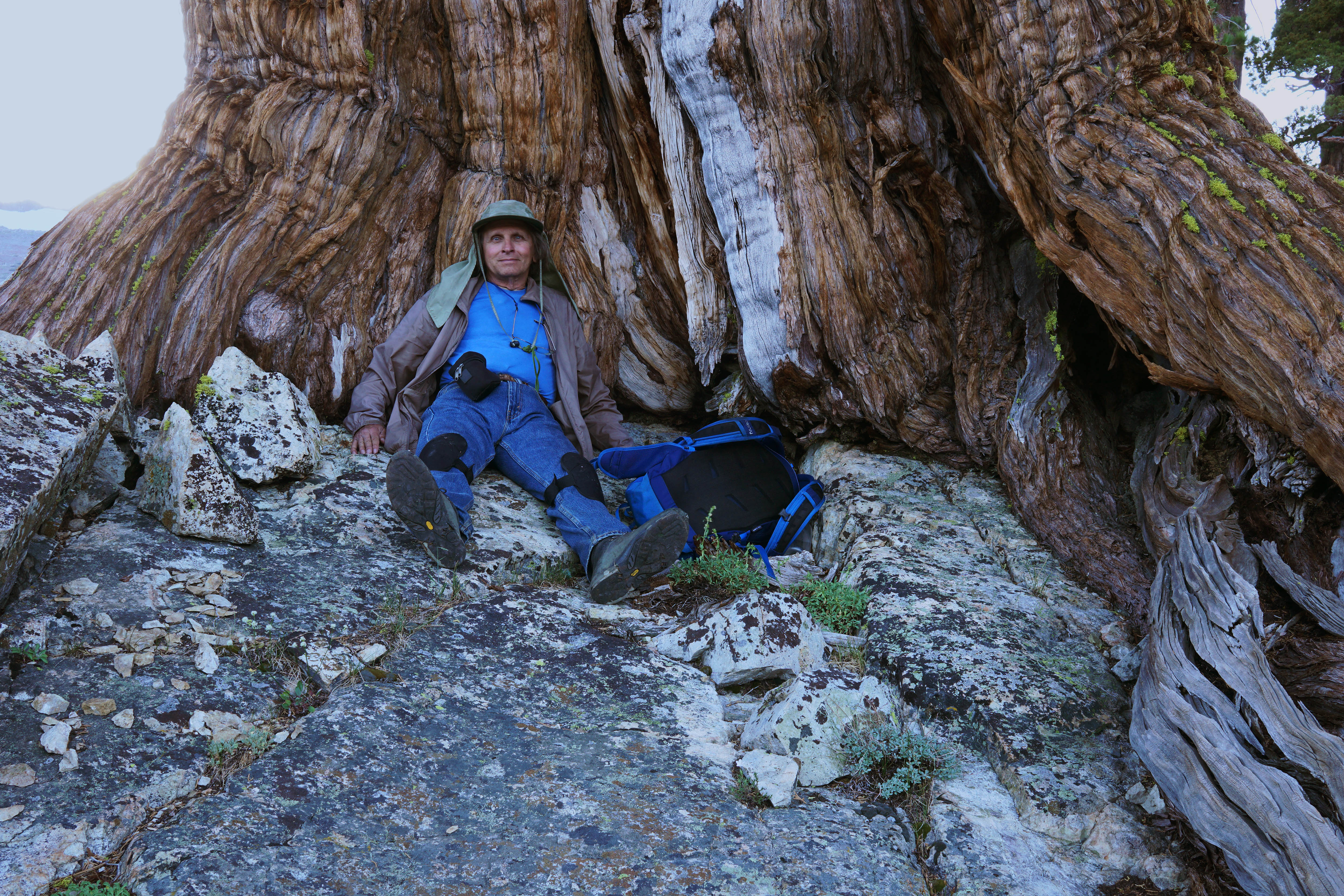
In 2019 I pleasantly base camped 2 nights where no others have reason to ramble about, well down stream at the orange D within a grove of tall trees along the creek that has lots of pristine campable spots. The south side of the Halfmoon zone is an excellent choice for a leisurely private base camp away from others while close to fun lake waters. It is also one of the best zones in Desolation for finding gnarly ancient Sierra juniper trees like this one near my camp.


SM09989y.jpg
 
Last edited:

Sponsor

Staff online

Top