Nah... I rarely see people with maps out. I think it will be a negligible difference.Now there will be 10-deep crowd looking at and puzzling over every big map at the top of the lifts.
-
For more information on how to avoid pop-up ads and still support SkiTalk click HERE.
You are using an out of date browser. It may not display this or other websites correctly.
You should upgrade or use an alternative browser.
You should upgrade or use an alternative browser.
Vail Resorts ends printed trail maps at all its locations
- Thread starter jt10000
- Start date
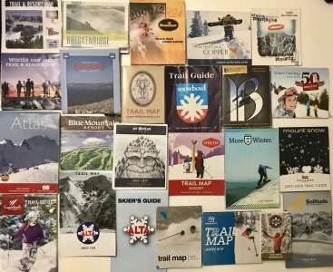
Plus….trail maps for me used to be souvenirs!
I would guess there will be non-singleuse trailmaps for sale in the shops for use or as real souvenirs.
Once they put a price on it, people will actually treat it as a souvenir rather than into the garbage.
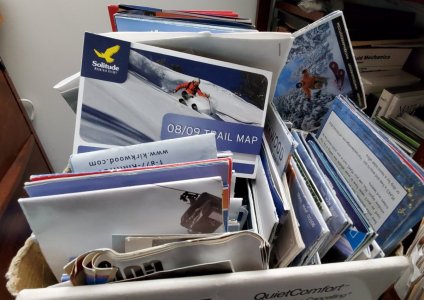
Wait, what are trail maps? Who would want those things?I have a stack of them for souvenirs. At the ski area I usually aim downhill and hope for the best.

- Joined
- Nov 12, 2015
- Posts
- 6,329
I'm not sure this is the best demographic for an objective review. IMV trail maps are absolutely critical for orientating oneself on a first visit to a resort and for those who say want to stick to easy blues they need to plot their way around the mountain.
I mean its not as if Vail has really simple geography to navigate ( looks at Breck peaks 6,7,8, WB, Vail back bowls etc).
For the naysayers - imagine going to an interconnected resort in Europe and just depending on the big boards in cable car and gondi stations to get yourself around. Perfectly possible to find yourself in the wrong village or even valley if you don't have a reference at critical junctions. And no, smartphones are not a substitute the APIs on most resort apps are slow.
Last edited:
Yup, pretty much the same. Running out of maps 16 years ago and stopping printing maps.Thanks for straightening this newb out. Sorry to have wasted your time with old news.Nothing new. Powdr ran out of trails maps at Park City three quarter way through the season about 16 years back.
They were just being cheap.
And if they wanted charging for them would reduce waste.A lazy decision in the guise of “environmental responsibility.” A paper trail map, opened up, gives the viewer perspective on the entire mountain that a trail map image on a smartphone simply cannot. Then there’s the issue of cell phone battery life and cell service, not to mention the threat of dropping one’s cell phone somewhere. Maps fold up easily and fit in small pockets and don’t require batteries. Also, why require somebody to have a cell phone to access a trail map?????
There’s such a thing as environmentally responsible paper products. VR could’ve put the time in for some out-of-the-box thinking and sourced recycled paper and offered creative options for its customers to recycle their maps. Heck, I used to collect trail maps. They were works of art. There even is a coffee table book on trail maps!
I use reading classes and don't look at trailmaps on paper outside - too fiddly etc. Only the giant maps on signs.That's me. I just can't be bothered with digging out a map, my reading glasses and fiddling with stuff.
This doesn't mean that I'm for or against vail nixing maps, just that I haven't found myself using them much for a while.
I do like the giant map at the top of the lifts.
But I do look at paper maps in the lodge or where I'm staying. At least for "destination" trips to bigger areas. Very important.
I write on my trail maps. Just for fun, at home.
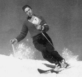
I carry trail maps in my pockets. If I find a skier down on the trail, I mark a trail map with the location and send a bypassing skier down with the map to the lift below. The map will be used to notify ski patrol of the location so they can come directly to the injured party.
My smartphone doesn't have coverage where I ski.
Printed trail maps cost money. Another shining example of Vail selling less for more. You can still bring a printed trail map to the hill, but you will have to get it off their web site and print it (and pay for printing it) yourself.
I usually just look at the map at the top; I don't want to stop skiing on the way down. I can still remember it well enough to find the bottom of the hill on my way down. I don't know it that will remain true if I get another concussion. I don't really care if I'm on a green, blue, black, double-black or even on a trail though. My daughter is more concerned about avoiding trails that are too difficult for her.
I usually just look at the map at the top; I don't want to stop skiing on the way down. I can still remember it well enough to find the bottom of the hill on my way down. I don't know it that will remain true if I get another concussion. I don't really care if I'm on a green, blue, black, double-black or even on a trail though. My daughter is more concerned about avoiding trails that are too difficult for her.
With a paper map, I can orient it the way I need to get perspective. On a trail map sign off the lift, such orientation is impossible. On maps of larger areas, I like to mark where I skied and where I’d like to go the next day. As a kid, I used to lie on the floor of our family room, pouring over an atlas. I’d study maps of different areas closely, and I continued that tradition as an adult on ski trips. The detail on some of those maps is really quite good.Now there will be 10-deep crowd looking at and puzzling over every big map at the top of the lifts.
Maybe it‘s my background that influences my opinion here. Having studied geology, I depended on maps of all kinds, made maps myself, worked problems with maps as an under layer. Used them to help identify features on satellite imagery. I’ve got framed maps in my house. I guess I love maps and see their value as something much more than a commodity to sell.

@Philpug ’s description of sitting around the table at night looking at the trail map with his family is really nice; also a good memory to cherish. Doesn’t VR even consider things like that? Why does everything have to be in the name of efficiency or the bottom dollar?
Last edited:
Vail's tag line? "Experience of a lifetime"Doesn’t VR even consider things like that? Why does everything have to be in the name of efficiency or the bottom dollar?

That is the one thing I agree is a positive. When you hand them out for free, many of them are wasted.I would guess there will be non-singleuse trailmaps for sale in the shops for use or as real souvenirs.
Once they put a price on it, people will actually treat it as a souvenir rather than into the garbage.
For the rest, agree with everyone above:
definitely use them in the evening to plan with the group, and prefer them on trail too. With adventurous kids, we often end up in weird places , so we do pull out maps mid run a fair bit.
A phone map is much harder to use (gloves off, small size).
The one thing that always bothered me about trail ’maps’ is that they are not. They are an artists impression. And although he (J.N.) does a beautIffull job , it’s a painting, not a map.
The only way to show all terrain, without hiding any of it, and showing what is uphill and downhill, is with a top view and contour lines.
So maybe the result of this*, is that I start using Caltopo for my skiresort navigation too.
*I don’t have an Epic pass, but I am guessing Alterra will be following right behind Vail on this (again)
Killington did that in the 1980s and I loved it.The only way to show all terrain, without hiding any of it, and showing what is uphill and downhill, is with a top view and contour lines.
I would typically grab a trail map but like many others are saying -- I rarely used them. Pulling them out, unfolding, etc. with gloves on in typically wintry conditions (windy, wet, etc.) -- ummm, right, whatever, it's kinda off to the right-ish here somewhere.
I used to collect trail maps and I had quite the stack going on a bookshelf and then I realized I never ever looked at them again either so they were chucked in the garbage long ago.
The trail maps on the safety bars are nice. I like the large ones at various prominent intersections --I've always found those to be the most useful.
There are various humorous videos on YouTube showcasing that the younger generation has no idea how to read a map anyway.
I'm actually surprised they didn't go this route first. People would still be up in arms about them charging. But if they put a $0.50-1.00 charge for a map, a family would grab one, instead of one for each family member, and an extra "just in case". To me, it would be a similar scenario of charging for a bag at the grocery store. The people that actually use them as maps or as souvenirs would probably still purchase, but it would cut back a lot of waste.And if they wanted charging for them would reduce waste.
- Joined
- Dec 19, 2015
- Posts
- 2,644
Count me in the group that is sad to see them go.
I have a collection and have made a big collage that hangs on the wall. Still have many more to make another.
I, as others here, like to pull it out at lunch and look at where we have been and plan where we are going.
I like to look at a trail map while riding up the lift.
I like to get a feel for a hill's layout and shape and will often pull a trail map out of my pocket.
I don't like downloading an app for every area I ski. Nor do I like pulling out my phone while on a chairlift.
I guess I can download pdf's and print them at home?
That person you see pulling out a paper map at mid-mountain? That’s me. I’d lose my orientation easily when exploring new terrain (does this Blue take me back to this Green, or to that Black?). This past April I went to Breck. They didn’t have any paper maps due to COVID and I had to use the EpicMix app. What a disaster. For whatever reason, every time I zoomed in, before I could figure out what I was looking at, the App refreshed and the map would zoom all the way out. It was unusable. They’ve updated EpicMix since then and you can download the trail map now. I’d still prefer paper maps. It’s not like my phone never died during the day.I'm not sure this is the best demographic for an objective review. IMV trail maps are absolutely critical for orientating oneself on a first visit to a resort and for those who say want to stick to easy blues they need to plot their way around the mountain.
I mean its not as if Vail has really simple geography to navigate ( looks at Breck peaks 6,7,8, WB, Vail back bowls etc).
For the naysayers - imagine going to an interconnected resort in Europe and just depending on the big boards in cable car and gondi stations to get yourself around. Perfectly possible to find yourself in the wrong village or even valley if you don't have a reference at critical junctions. And no, smartphones are not a substitute the APIs on most resort apps are slow.
Good Move Vail.
You'll sell a lot more Spanky Lens clothes with the map on them. Everybody else sells them for about $5. Yours should be worth twice that now?
You'll sell a lot more Spanky Lens clothes with the map on them. Everybody else sells them for about $5. Yours should be worth twice that now?
this really blurs the line of what you can do and what you should do. Can you eliminate paper maps? Yes. Should you? No. I would be interested in hearing what the actual production of the maps are and what is left at the end of the season which IMHO where the waste probably is and if thats IS the case, they are throwing out the baby with the bathwater.


