Snow Porn. Bring it on!
-
For more information on how to avoid pop-up ads and still support SkiTalk click HERE.
You are using an out of date browser. It may not display this or other websites correctly.
You should upgrade or use an alternative browser.
You should upgrade or use an alternative browser.
California/Nevada 2021-2022 Tahoe Ski Resorts/Conditions/Meetups
- Thread starter Andy Mink
- Start date


- Status
- Not open for further replies.
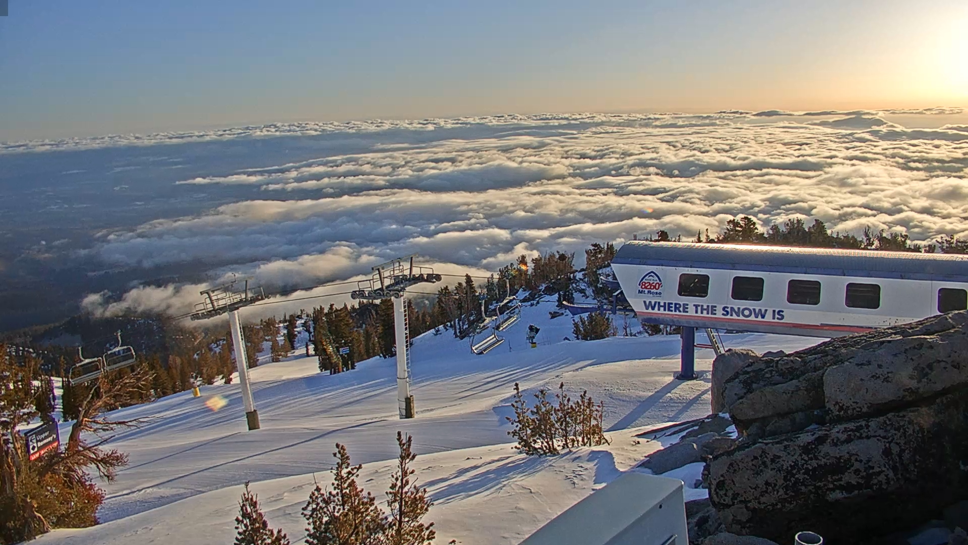
Damn, had snow trace in some pass between Reno and Utah state line.Mt. Rose from south Reno! View attachment 144376
Tahoe doesn't read like storm round 2 will amount to much though areas south of US50 may make up for round 1 since they received less snow than North Tahoe. Big gain will be the extra cold lower elevation temps are key to further chilling ground temps for whatever real accumulations we see. Also, time of year given NW flows when Heavenly could see surprise lake effect snow. Below is interesting enough that next week will slowly pull my winter gear and clothing out of storage trading in the summer backpacking stuff. Car too needs some prep like new tires.
Area Forecast Discussion
National Weather Service Reno NV
231 AM PDT Sun Oct 10 2021
...There may be a bit of enhancement in the Sierra south of
Tahoe late Monday morning due to upslope flow and frontal forcing.
These locations could pick up several inches of snow, but
probabilities are less than 10% for reaching 6" or greater...
Elsewhere, a dusting up to possibly 1" (for foothill locations) is
most likely...
Looking ahead to next week (starting October 18), the weather
pattern could become more active again. Some model simulations
bring precip to the Sierra as soon as Monday the 18th, while
others hold off until around the 20th. Still others indicate a
blocking ridge near the Great Basin which would divert the storm
track well to the north and west of the Sierra. There are
indications of an atmospheric river setting up next week, although
the best feed of IVT (moisture) currently favors areas north of 42
degrees latitude--too far north for bringing significant precip
to the Sierra or western NV.
Storms now are really just an inconvenience ... unless you take into account that we need whatever moisture we can get.
Yeah, good for hype pics... and relief that the "fire season" is ending for this year.Storms now are really just an inconvenience ... unless you take into account that we need whatever moisture we can get.

- Joined
- Jun 6, 2016
- Posts
- 2,733
In light of the 55 mph gusts forecast for the valley today, I think it may be a ways out yet. I guess we can say it's closer than a month ago, but using the e word makes me flinch.Yeah, good for hype pics... and relief that the "fire season" is ending for this year.
See What Conditions Are Like At Mt. Rose Right Now Via Our Webcams
Browse our 24/7 webcams from different elevations and regions throughout the mountain to get a better idea on weather and ski conditions, crowds, and more. Good for daydreaming when your stuck in the office, too.
 skirose.com


That area needs all the liquid it can get.
Is this the first Chain control of the season?
Looking at resort cams, radar, satellite, and forecasts as this systems dives into the Great Basin where it may circulate longer than earlier forecast, Mammoth could receive enough minimum base to open early beating any Tahoe resorts. Utah also getting a stronger dose.
 www.mammothmountain.com
Mammoth Mountain Unbound Main Cam | Official Site
Check out live views from the Mammoth Mountain Unbound Main Cam. Catch real-time live action at the base of Mammoth Mountain's Unbound park.
www.mammothmountain.com
Not only is Mammoth showing 6 to 8 inches, but this morning, all their snow guns are adding more with groomers flattening out possible early run lines that shows they may be reconsidering their stated mid November opening. Long range forecasts are hinting at a potential for a more serious Sierra cold storm that could make that happen and higher Tahoe resorts are no doubt looking ahead too.

Cold & Snowy Start, Warming Later in the W... | Tahoe Daily Snow Forecast | OpenSnow
We have another snowy morning this morning. The cold front brought a burst of snow as it moved through Monday morning as expe...
opensnow.com
"Snow showers Monday morning. Then a cold northeast wind event Monday afternoon into Tuesday morning. Chill through Thursday. Then warming with nice weather through the weekend. Bigger storms are possible starting around the 22nd."
Might be some "atmospheric rivers" lining up.
We may be in for something good here, as the Chronicle reported “possible near-record-breaking precipitation for late October” according to the National Weather Service.
Tentative opening dates
Thread Starter
TS
Andy Mink
Everyone loves spring skiing but not in January
Moderator
SkiTalk Tester
SkiTalk Supporter
Cool. Rose was saying 11/12 earlier. I'm still holding out for 10/29!Tentative opening dates
Impressive "dusting" at Sugar Bowl
Im hoping to hit Sugar Bowl, never been, after thanksgiving weekend. In ‘general’ what can I expect early season there? Does it need alot of snow to open some steeper stuff?
^Honestly, I would not expect much, but you never know!
- Status
- Not open for further replies.
Sponsor
Staff online
-
 dbostedoAsst. Gathermeister
 -
 Dave PetersenGraphic Designer/Social Media Manager
 -
 PhilpugNotorious P.U.G.
 -
 Andy MinkEveryone loves spring skiing but not in January
Members online
- David Chaus
- doc
- crgildart
- OddTurn
- tomahawkins
- Jersey Skier
- Pukesno
- oldfashoned
- dbostedo
- mcmary
- Dave Petersen
- Noodler
- jetwolverine
- Wade
- Yepow
- Peb75
- socalgal
- JShort
- SpeedyKevin
- GregK
- Bad Bob
- Chris V.
- AngryAnalyst
- David
- Plai
- nnowak
- dovski
- Philpug
- Even_Stevens
- Wasatchman
- Chewski
- Kyle
- altabrig
- peterm
- The Retired Skier
- P-Ute
- AltaSkier
- DanoT
- SKI-AJM
- Cameron
- mdf
- Wvguy
- xiskiguy
- Jelder
- Mallet21
- blackke17
- LuliTheYounger
- Maryb
- Andy Mink
- applecart
Total: 3,161 (members: 122, guests: 2,052,robots: 987)